Using space technology and AI for disaster management
Bangladesh already receives enormous amounts of satellite data free of charge from international missions (such as Sentinel, Landsat, GPM, SWOT, etc.). The available data is often of very low-resolution data, and also not real time data. Developing its own Earth observation (EO) satellite capability would enable the country to access high-resolution, real-time data

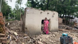
Bangladesh is experiencing severe flood at this moment. As it seems, the available forecast and/or warning was very limited beforehand. Earth Observation (EO) satellites cannot stop floods, but they can transform flood management from reactive to predictive.
Bangladesh already receives enormous amounts of satellite data free of charge from international missions (such as Sentinel, Landsat, GPM, SWOT, etc.). The available data is often of very low-resolution data, and also not real time data. Bangladesh's own EO satellite solutions can provide high-resolution data in real time.
The challenge is not only the lack of satellite data— but also it is the lack of an integrated national system that converts satellite data into actionable, location-specific warnings and decisions.
 Keep updated, follow The Business Standard's Google news channel
How earth observation satellites can predict floods
Flood forecasting is much more than weather forecasting. It requires combining information from multiple satellite systems.
Monitoring rainfall before it reaches Bangladesh
Heavy flooding in Bangladesh is often caused by rainfall over certain places outside Bangladesh, e.g. India's Meghalaya Plateau, Assam, Arunachal Pradesh, Bhutan, Nepal and Parts of Tibet, etc. Earth observation satellites continuously measure several aspects, such as rainfall intensity, storm movement, cloud development, soil moisture, etc in the rainy areas.
This will provide necessary information to the authority. As an example, this allows authorities to know, "Extremely heavy rainfall is occurring 300 km upstream. The resulting water is likely to reach Sylhet in 24–48 hours."
There are a number of systems that perform the above procedure, which include NASA's GPM (Global Precipitation Measurement), EUMETSAT Meteosat satellites, Himawari-9
Measuring river water before flooding occurs
Modern satellites can estimate river width, river height, flow velocity, surface water expansion, etc. So, large rivers such as the Brahmaputra, Ganges and Meghna can be monitored continuously via modern EO satellites.
This will ensure that, if water levels in Assam suddenly increase, Bangladesh immediately knows what is coming. This provides several days of additional warning.
Measuring soil moisture
Flood severity depends not only on rainfall. Soil moisture plays an important role. If the soil is already saturated, even moderate rainfall can produce severe flooding. Microwave satellites can measure soil moisture regardless of cloud cover within Bangladeshi boundaries. This enables prediction of whether rain will soak into the ground or rapidly become floodwater.
Flood mapping during heavy clouds
Due to the technical characteristics, optical satellites cannot see through clouds.
Synthetic Aperture Radar (SAR) satellites produce flood maps even at night, during monsoon through heavy clouds.
Bangladesh's own SAR satellite can provide high-resolution real-time data for flood mapping even at high cloud situations. Some established satellites such as Sentinel-1, RADARSAT, TerraSAR-X can also provide some historical data which can be used with their own data for prediction estimations.
Flood mapping functionalities will ensure that emergency responders immediately know which villages are submerged, which roads remain usable, which bridges are threatened, which evacuation routes remain open, etc.
Digital elevation models (DEM)
Flood prediction also requires highly accurate elevation maps. Even a difference of 20–30 cm can determine whether an area floods. Combining satellite DEM, LiDAR, and drone surveys produces highly accurate inundation models.
Forecasting riverbank erosion
Bangladesh loses enormous amounts of land each year due to river erosion. Satellite images taken over many years reveal river migration, erosion hotspots, unstable embankments, etc. Thus, using the satellite based data, authorities can prioritize reinforcement before the monsoon.
Reservoir and dam monitoring upstream
Satellites can also monitor reservoir storage, lake expansion, sudden releases, etc. Combined with international data sharing, Bangladesh can gain advanced knowledge of downstream flood risks.
Artificial Intelligence and machine learning makes satellite data useful
Acquiring the required data is challenging, however even more challenging is to make sense out of the data once they are acquired. Here lies the magic. The future lies in combining information and data from satellites with AI and machine learning.
AI can learn from 30 years of flood history, satellite rainfall, river levels, land elevation, soil moisture, tidal information, historical disaster records, etc. Instead of simply saying: "Heavy rainfall is expected", an AI based system can estimate: "82% probability of flooding, expected water depth, expected arrival time, population affected, cropland at risk, roads likely to be submerged, schools needing evacuation, etc." This becomes impact-based forecasting, which is far more useful than weather forecasts alone.
A national flood digital twin
One of the most exciting possibilities is creating a Digital Twin of Bangladesh.
This would integrate: Earth observation satellites, Weather satellites, River gauges, IoT water-level sensors, Radar, Drone imagery, AI prediction models, etc. Based on input from all these sources, the system would update automatically on real time (e.g. every hour). Decision-makers could visualize the current flood extent, water movement, expected flood in at different time spans (e.g. in 6 hours, or in 24 hours, or in 72 hours or in one week), etc. This would support evacuation, relief logistics, crop protection, and infrastructure management, among others.
What Bangladesh Should Build
Bangladesh already has excellent institutions such as the Bangladesh Meteorological Department (BMD), the Flood Forecasting and Warning Centre (FFWC), Bangladesh Satellite Company Limited (BSCL) and the Space Research and Remote Sensing Organization (SPARRSO). The next step is to integrate their capabilities into a unified national platform.
I would recommend establishing a National AI-Enabled Earth Observation and Disaster Intelligence Centre with the following components:
|
Space Segment |
• Commercial high-resolution imagery from Bangladesh's own EO satellites (when available) and from overseas sources until a native system is in place • Free EO satellite data (Sentinel, Landsat, GPM, SWOT, etc.) to acquire historical information |
BSCL and Sparso can work together in establishing the EO satellite constellations. |
|
Ground Segment |
• National satellite receiving stations • High-performance computing • Cloud processing |
BSCL's current facilities in Gazipur and Betbunia ground stations can be reused. |
|
AI Layer |
• Flood prediction • Landslide prediction • Cyclone impact prediction • River erosion prediction • Agricultural damage estimation |
BMD, FFWC, BSCL and Sparso can work together to build the AI models and the infrastructure. Strong academia collaboration can also be formed. |
|
Communication Layer |
• Mobile alerts • Television • Community warning systems • Satellite communications when terrestrial networks fail |
Collaboration between Mobile operators, TV stations and other communication channels are needed |
|
Decision Layer |
Dashboards for: • Prime Minister's Office • Disaster Management authorities • District administrations • Armed Forces • Local governments • Farmers and citizens |
A Vision for Bangladesh
In my view, Bangladesh should move beyond viewing satellite technology as primarily a communications service. Earth observation should become a pillar of national resilience and economic development. By combining Bangladesh's own real-time, high resolution imagery via the forthcoming EO satellite systems with freely available satellite imagery and AI, ML based algorithms, hydrological models, IoT sensors, and modern communication networks, Bangladesh could build one of South Asia's most advanced flood forecasting and disaster management systems.
For an integrated national approach, I would envision a National AI + Space Programme with four strategic pillars:
Predict
Use Earth observation satellites and AI to forecast floods, cyclones, river erosion, droughts, and crop stress.
Protect
Deliver targeted early warnings and support resilient infrastructure planning.
Respond
Coordinate rescue, relief, and logistics using near-real-time satellite intelligence.
Recover
Assess damage rapidly to guide reconstruction, insurance, and long-term resilience.
Given the proven benefits in integrating AI, satellite technology, and national digital infrastructure, this could form the foundation of a comprehensive national initiative—one that positions Bangladesh not only to respond more effectively to disasters but also to become a regional leader in the use of space technology for sustainable development.
The author is a Tech Professional and the Managing Director & CEO of Bangladesh Satellite Company Limited, a state-owned enterprise under Post and Telecommunications Division.